MIAMI (AP) — A weather system, anticipated to transform into Tropical Storm Imelda shortly, is expected to approach the South Carolina coast as a hurricane early next week, causing disturbances across the Bahamas and nearby islands this Sunday.
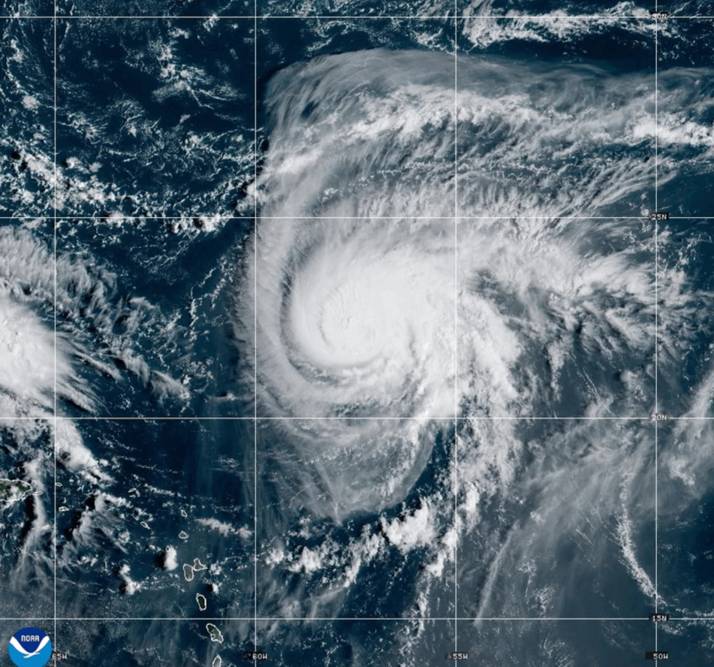
In parallel, Hurricane Humberto has weakened slightly but remains a strong Category 4 storm that poses a threat to Bermuda.
South Carolina Governor Henry McMaster has advised residents to stay alert and monitor the evolving weather situation closely. In a proactive response, North Carolina Governor Josh Stein has declared a state of emergency in anticipation of Tropical Depression Nine.
Forecasters predict that the system could evolve into a tropical storm later today and strengthen into a hurricane by late Monday or Tuesday, officially named Imelda.
As of 0900 GMT on Sunday, the disturbance was located approximately 100 miles (160 kilometers) west-southwest of the Central Bahamas, traveling north-northwest at a speed of 7 mph (11 kph), with maximum sustained winds of 35 mph (55 kph).
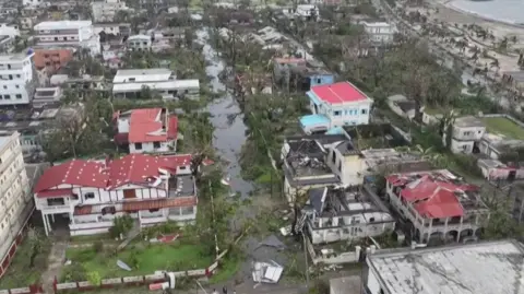
During a news conference, McMaster emphasized, “This storm is deadly serious. Not just serious. Deadly serious.” He warned that the storm could bring high winds and heavy rains, leading to potential flooding, and the state has pre-positioned search and rescue crews.
Hurricane Humberto Remains a Major Storm
Hurricane Humberto continues to pose a major threat with maximum sustained winds reaching 155 mph (250 kph). It is currently situated about 585 miles (945 kilometers) south of Bermuda and is moving west-northwest at 13 mph (20 kph). A tropical storm watch for Bermuda may soon be necessary as swells could impact the U.S. east coast.
Meanwhile, Tropical Depression Nine threatens heavy rainfall and flash flooding across parts of Cuba and the Bahamas, with tropical storm warnings already in effect for some areas.
The Bahamas’ Department of Meteorology has urged residents in northwest and central islands—like Nassau and Andros Island—to finalize preparations for adverse weather conditions, advising those in low-lying areas to take necessary precautions against flooding.
In a separate weather update, Tropical Storm Narda in the Pacific, previously a hurricane, is about 1,045 miles (1,680 kilometers) west-southwest of Baja California, moving north at 5 mph (7 kph) with maximum winds of 60 mph (95 kph). Narda's swells are impacting coastal Mexico and Baja California Sur, with warnings of hazardous surf and rip currents in Southern California.
___
Report contributed by Associated Press writer Regina Garcia Cano from Caracas, Venezuela.