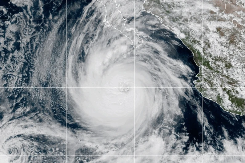
MIAMI (AP) — Hurricane Priscilla weakened in the Pacific as it moved alongside the west coast of Mexico on Wednesday. Meanwhile, Tropical Storm Jerry in the Atlantic was projected to intensify on a path towards the Leeward Islands, according to forecasters.
Priscilla approached major hurricane status earlier this week but has since weakened to a Category 1 storm with maximum sustained winds of around 80 mph (129 kph), reported the U.S. National Hurricane Center in Miami.
Despite its weakening, heavy rainfall and flash flooding remain concerns along Mexico’s Pacific coast and are expected to extend into the Southwestern United States later this week and into the weekend.
The hurricane was moving northwest at 8 mph (13 kph), located about 195 miles (314 kilometers) southwest of the southern tip of Baja California.
On the other hand, Tropical Storm Jerry currently has top winds of 50 mph (80 kph) and is situated around 835 miles (1,344 kilometers) east-southeast of the northern Leeward Islands, advancing northwest at 23 mph (37 kph).
Forecasters anticipate that Jerry will evolve into a hurricane by Thursday, with the core of the storm expected to reach near or north of the northern Leeward Islands late Thursday into Friday.
In light of Jerry’s approach, a tropical storm watch is in effect for Antigua, Barbuda, Anguilla, St. Kitts, Nevis, and Montserrat, as well as St. Barts, St. Martin, and Saba, and St. Eustatius.
Concerns also arise from Hurricane Priscilla as a tropical storm watch due to its approach is currently in place for Baja California Sur, affecting areas from Cabo San Lucas to Cabo San Lazaro.
Meanwhile, waves generated by Priscilla are causing disturbances along parts of southwestern Mexico's coastline, as well as the southern Baja California peninsula. Farther out, Tropical Storm Octave is gradually weakening approximately 720 miles (1,159 kilometers) southwest of the southern tip of Baja California, with winds at 40 mph (64 kph) and expected to dissipate without threatening land.