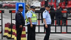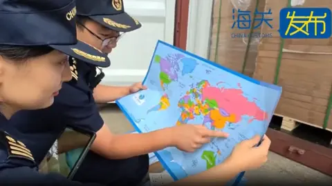
Chinese customs officers in eastern Shandong province have seized 60,000 maps that mislabelled the self-governed island of Taiwan, which Beijing claims as part of its territory.
The maps, authorities said, also omitted important islands in the South China Sea, where Beijing's claims overlap with those of its neighbors, including the Philippines and Vietnam.
The problematic maps, meant for export, cannot be sold because they endanger national unity, sovereignty and territorial integrity of China, authorities explained.
Maps are a sensitive topic for China and its rivals for reefs, islands, and outcrops in the South China Sea.
China Customs noted that the maps did not include the nine-dash line, which demarcates Beijing's claim over nearly the entire South China Sea, a contentious issue in the region.
Additionally, the seized maps inaccurately depicted the maritime boundary between China and Japan, further complicating the diplomatic tension in the area.
Authorities indicated that the maps referred to Taiwan as Taiwan province, yet specifics regarding the mislabeling were not detailed.
China considers self-ruled Taiwan its territory and has not ruled out using force to take control of the island, whereas Taiwan operates under its own government and views itself as independent.
Tensions surrounding the South China Sea flared recently, with an incident involving ships from China and the Philippines sparking allegations of aggressive actions from both sides.
In previous months, Chinese customs have routinely confiscated other maps that were deemed incorrect in their border representations.
The recent confiscation is one of the largest of its kind, drawing attention to the delicate balance of territorial representation in this politically charged scenario.